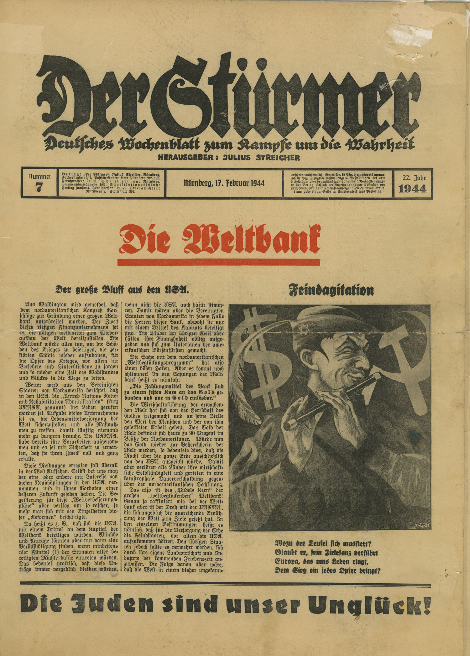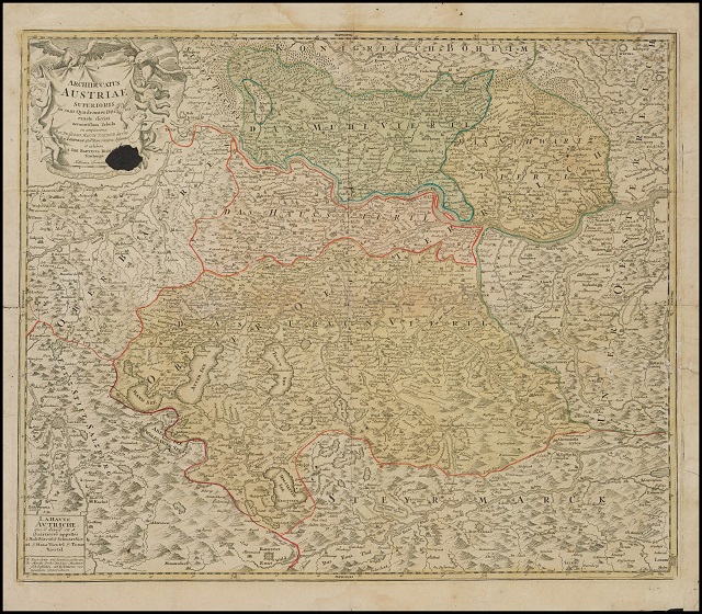
These valuable maps are among the six maps and other items confiscated from Adèle Eisenschiml by the Nazis in 1938. They are three lithographed maps of Bavaria, Austria and Moravia, published by Johann Johann Baptist Homann (1664-1724) in the 18th century. Homann was renowned for his distinguished, colorful artistic style and allegorical cartouches.
18th-century maps confiscated by the Nazis

Map of the area around Lichtenfels, Bavaria. Augustin Christoph Hannbaumb and Königl Kauptmann produced it in Bamberg around 1820.
Carte qui illustre la Haute-Autriche. Les lieux de cultes, les espaces militaires et résidentiels, les cours d'eau et les zones forestières y sont tous répertoriés. La Haute-Autriche comprend traditionnellement quatre régions administratives, quatre « quartiers », soit le quartier de Hausruck, le quartier de l’Inn, le quartier de Mühl et le quartier de Traun. La carte a été créée aux alentours de 1710, par le cartographe Georg Matthaeus Vischer, puis éditée par Johann Baptist Homann.

The Anschluss
From 1933 onwards, Germany and its Austrian Nazi supporters exerted pressure for the unification of the two nations. Known as the Anschluss, this annexation was an important step for the Nazi government. The goal was to unite the German and Austrian populations into a single Reich based on self-determination. The Wehrmacht, the army of the Third Reich, entered Austria on March 12, 1938 and began its annexation, violating the Treaty of Versailles and the Treaty of St. Germain. Following this event, Austria ceased to exist as an independent nation until 1945, and antisemitic demonstrations escalated. In addition to public humiliation, antisemitic laws were implemented to restrict the economic and social capital of Jewish communities in Austria.
Adele’s arrest
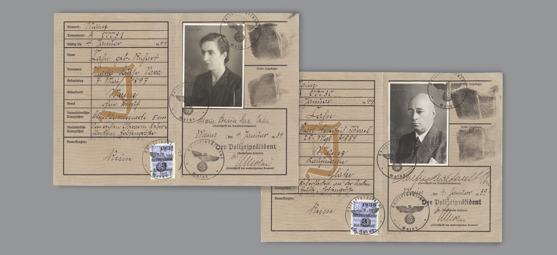
In July 1938, Adèle boarded the Arlberg Express in St-Anton to visit her son Georg in Paris. The Gestapo, who accused her of embezzlement, arrested Adele at the Feldkirch border. She was detained for three days and was interrogated by the Gestapo, who stigmatized her for being a member of the Jewish community. Six antique maps, money and jewelry were seized from her. Four of these maps were held at the court in Feldkirch before joining the Vorarlberg archives in 1992. In 2019, Adele’s descendants received four of the six cards following a restitution request made by Sheila Murphy, Adele Eisenschiml’s great-granddaughter. This was part of a resolution passed by the Voralberg government in 2003 to provide reparations to victims of the Holocaust. The two missing maps were never preserved in the archive’s collection and are still to be found, highlighting, among other things, the many consequences of spoliation.
Sheila Murphy donated three antique maps to the Montreal Holocaust Museum in 2021.
This project is part of a grant from the Claims Conference.
![]()